Nightstar The Bright Posted November 23, 2023 Report Share Posted November 23, 2023 Like the title suggests, where are T’Telir and Bevalis located (within their respective nations)? Is there anything within the books that hints at locations? 0 Quote Link to comment Share on other sites More sharing options...
alder24 Posted November 23, 2023 Report Share Posted November 23, 2023 20 minutes ago, Nightstar The Bright said: Like the title suggests, where are T’Telir and Bevalis located (within their respective nations)? Is there anything within the books that hints at locations? We don't know. Idris is north of Hallandren and that's the only thing we know. It took days for Siri to travel to T'Telir, more than a week - but we don't know any concrete numbers, it might be a month or so - and she passed through several smaller cities of Hallandren before reaching T'Telir. That's all I've been able to find. For more we have to wait for an official map, but for that we have to wait for the sequel - Nightblood - but unfortunately Brandon has no plans of writing it in the nearest 6-8 years. ch 4: Quote The carriage had passed through cities as they’d made their way to T’Telir. Coppermind: Quote The city of T'Telir is built in a crescent around a bay of the Bright Sea, abutting the water. This position means the city wall only has to run around the landward half-circle of the city. The city is designed with many gardens and open spaces that show off its greenery and has palm trees and other flora growing along the streets.[1][3] Like most of Hallandren, T'Telir is in the lowlands in a tropical climate: the temperature is quite warm, colorful animals and flowers are common, and harsh weather is rare.[4][5] The Court of Gods stands on a small plateau that rises above the city with a spectacular view of the sea.[1] The city's placement on the sea makes it a choice location as a port; because of T'Telir's unique climate, it has a monopoly on dye production from the Tears of Edgli.[6] Other nations use the sea to bring exotic merchandise and fresh foods from their lands in trade.[7] 1 Quote Link to comment Share on other sites More sharing options...
Nightstar The Bright Posted November 23, 2023 Author Report Share Posted November 23, 2023 4 minutes ago, alder24 said: We don't know. Idris is north of Hallandren and that's the only thing we know. It took days for Siri to travel to T'Telir, more than a week - but we don't know any concrete numbers, it might be a month or so - and she passed through several smaller cities of Hallandren before reaching T'Telir. I found that Idris has garrisons in striking distance of T’Telir. Also, apparently T’Telir is closer to the lower farms of Idris then Bevalis. This suggests that T’Telir is in the North don’t you think? 0 Quote Link to comment Share on other sites More sharing options...
alder24 Posted November 23, 2023 Report Share Posted November 23, 2023 (edited) 13 minutes ago, Nightstar The Bright said: I found that Idris has garrisons in striking distance of T’Telir What does it mean? It can mean weeks of marching. It doesn't really explain anything. 13 minutes ago, Nightstar The Bright said: Also, apparently T’Telir is closer to the lower farms of Idris then Bevalis. This suggests that T’Telir is in the North don’t you think? Or Bevalis is farther away from the border than T'Telir is. Or that Hallandren is spanning west to east, not south to north. It can mean a lot of things. Without maps this provides us with nothing. Edited November 23, 2023 by alder24 1 Quote Link to comment Share on other sites More sharing options...
Nightstar The Bright Posted November 23, 2023 Author Report Share Posted November 23, 2023 4 minutes ago, alder24 said: What does it mean? It can mean weeks of marching. It doesn't really explain anything No it doesn’t explain, but it’s not likely to be weeks of marching, otherwise they wouldn’t be in ‘striking distance’ but nonetheless your right that we don’t know much, but I think it’s unlikely T’Telir is located in the south of Hallandren. I just wanted to know if there was any information about it in the book, turns out there isn’t. Thanks. 1 Quote Link to comment Share on other sites More sharing options...
alder24 Posted November 23, 2023 Report Share Posted November 23, 2023 2 minutes ago, Nightstar The Bright said: No it doesn’t explain, but it’s not likely to be weeks of marching, otherwise they wouldn’t be in ‘striking distance’ The striking distance means something else in the modern era with tanks and planes compared to the medieval era with foot soldiers and slow supply wagons. 7 minutes ago, Nightstar The Bright said: I think it’s unlikely T’Telir is located in the south of Hallandren Not knowing what Hallandren looks like on the map I wouldn't say that. If Hallandren is a long strip stretching east to west then north or south means basically the same. I wish there was a map in Warbreaker 0 Quote Link to comment Share on other sites More sharing options...
Treamayne Posted November 24, 2023 Report Share Posted November 24, 2023 3 hours ago, alder24 said: I wish there was a map in Warbreaker Unfortunately there is not likely to be one any time soon. Annotations to Ch 32: Spoiler I wasn’t sure if I wanted a map of the world in the front of this book or not. The problem is, if I give a world map, I risk doing it wrong. It takes a very specific set of geographic requirements for a rain forest to work, and what I wanted here was a kind of rain forest valley, irregular and out of place in the world. In the abstract, that can work—but the more details I pin down in the map, the less likely it is to be believable. There are a few things that can be derived by available information: Siri travels South to reach T'Telir, which curves around a bay on the Bright Sea Which imples that Hallendren is on the North Shore of the Bright Sea. Siri travels at least a week (assuming synchratic time - at least this early. Vivenna, with Fafen in Ch 2 notes it's been a wek since Siri left, Siri arrives in Ch 4) This implies that the "cold and short summers" of Bevalis are a considerable altitude over the T'Telir tropical rainforest environment Tedredel lies "across the Bright Sea" Which implies it is South of Hallendren Which Implies that the continent is a Southern Hemisphere Continent, if Hallendren is to the North (or possibly central) but still equatorial enough to have a rain forest valley. In my mind, the Bright Sea might be something like the Mediterranean, if teh Med we on a Latitiude similar to the Carribean - which would make the Idrian Highlands soemthing similar to the Alps - high enough for a radiacally diferent climate, but situated in the landmass to all lower-lying countries both North and South of Idris. References: Spoiler Ch 1: Quote Despite the advent of spring, his chamber was cold. Warmth was a rare thing in the Idris highlands; it was coveted and enjoyed, for it lingered only briefly each summer. Ch 2: Quote And yet, as she considered it, there was someone who still needed her. Someone who had left a week before, teary-eyed and frightened, looking to her big sister with desperation. Ch 9: Quote The inland sea made all the difference. T’Telir was a prime port, and the dyes it sold—made from the Tears of Edgli, a local flower—made it a center of trade. She could see the evidence all around her. Exotic silks and clothing. Brown-skinned traders from Tedradel with their long black beards bound with tight leather cords into cylindrical shapes. Fresh foodstuffs from cities along the coast. In Idris, the population was spread out thinly across the farms and rangelands. In Hallandren—a country that controlled a good third of the inland sea’s coast—things were different. They could burgeon. Grow. Ch 25: Quote The tubelike dress was made after a foreign cut, from Tedradel, across the Inner Sea. It came down almost to her ankles, and though its snugness emphasized her bust, at least the garment covered her almost up to the neck, and had full-length sleeves. 1 Quote Link to comment Share on other sites More sharing options...
alder24 Posted November 24, 2023 Report Share Posted November 24, 2023 I did more digging on the Coppermind and here are the results: The Bright Sea, called the Inner Sea by Idris, is a landlocked body of water - I think it's probably something like the Caspian Sea, the Black Sea or the Mediterranean Sea. The founders of Hallandren, Chedesh, sailed from the east, opposite from Hallandren. Hallandren is situated on its western shore and it controls more than a third of the sea's shoreline. The Idris mountains are north of Hallandren, but there is another mountain range eastwards (??? that's where the sea should be, Halladren is on the north-western corner of the sea? those second mountains should be on the west, thus they would help create the environment necessary for the jungle to grow). To the south of Hallandren is the province of Pahn Kahl. Hallandren is the only tropical region in this area. I think it's more likely that the Bright Sea is similar in size to the Black Sea, because I doubt Hallandren is the size of the Eastern Roman Empire and on top of that mostly covered by jungle. Hallandren seems to control both northern and western shores of the Bright Sea, with Idris mountains separating it fully from northern kingdoms, and T'Telir being located more in the north-western corner of the sea. Hallandren's jungle is unique, out of the place, and this is most likely the result of investiture seeping into the ground from Endowment's perpendicularity - thus it doesn't have to correspond to locations of jungles on Earth. Coppermind: Spoiler https://coppermind.net/wiki/Hallandren#Geography_and_Ecology Quote Hallandren is located in the Jungle valley on Nalthis. It is unique in the known world of Nalthis as being the only place that Tears of Edgli will grow, as well as being the only known jungle climate.[2] The growth of plants in this region is partly helped by Investiture, much like the Elendel Basin.[3] To Hallandren's east,[4] there is an inland sea that features several islands.[5] At least a third of the coastline is controlled by Hallandren, which has its capital city built abutting the water.[6] The area suffers frequent earthquakes.[7] There are mountains north of Hallandren, as well as toward the sunrise. To the south of Hallandren is the province of Pahn Kahl.[8] Elephants and zebras are said to be exotic creatures from "the south." Whether this means they come from southern Hallandren or south of Hallandren is unclear.[9] The Hallandren jungle is inhabited by panthers, parrots, monkeys, and crocodiles.[2][10]{{book ref|wb|27} The people at the edges of the kingdom of Hallandren, have dark skin, however since Siri notes this, it may be that the people at the northern border have dark skin. People here also dye their hair.[citation needed] https://coppermind.net/wiki/Chedesh Quote The Chedesh people are credited with discovering the tropical, jungle region that would later be Hallandren, along with the Tears of Edgli,[1] though the Pahn Kahl are originally native to the region. Vo was on a Chedesh ship, and Returned along the coast of Hallandren. The people of that ship found a kingdom, which they name Hanald, on the beach that T'Telir is located. Hanald is eventually renamed to Hallandren, its modern name. The people of Chedesh travel the Bright Sea from the east, opposite from Hallandren, which is a similar description as to where Tedradel is from, so Tedradel could be where Chedesh was originally. https://coppermind.net/wiki/Bright_Sea Quote The Bright Sea is its original name. Since Idris split from Hallandren, Idrians call the sea the Inner Sea, to downplay its importance, since Idris was landlocked. Idris and Hallandren usually have different names for geographical features, due to the bad blood between them. However, in many cases, both names stuck, so Inner Sea and Bright Sea are used interchangeably by many.[2][3] Geography The people of Chedesh sailed the Bright Sea, coming from the east, and first discovered the place that would later be named Hallandren.[4] At the time of the Pahn Kahl rebellion, Hallandren owns approximately one third of the coast of the Bright Sea.[5] Tedradel is also on the far side of the Bright Sea to Hallandren and Idris.[6] The Pahn Kahl believe that the storms of the Bright Sea are a manifestation of their unity of five gods.[3] WoB Mistborn spoilers: Spoiler Questioner Is there a similar relationship between Endowment and Hallandren's jungle as there is between Harmony and Elendel Basin ? Brandon Sanderson Yes and no. The flowers are being fed by something that's very similar to what you might find on other planets. So the ground is saturated with something that is having a similar effect as Elendel Basin. But it's not the same thing. Elendel Basin was just crafted really, really well, and then it was endowed with a little bit of extra oomph. Here [in Hallandren's jungle], we have this extra seeping into the ground from the pool, which is saturated around and causing the flowers and causing what's going on there. SpoCon 2013 (July 10, 2013) 1 Quote Link to comment Share on other sites More sharing options...
Nightstar The Bright Posted November 25, 2023 Author Report Share Posted November 25, 2023 On 11/24/2023 at 2:09 AM, Treamayne said: Siri travels South to reach T'Telir, which curves around a bay on the Bright Sea Which imples that Hallendren is on the North Shore of the Bright Sea. She does indeed, but why does this mean that Hallandren is on the northern shore, The coppermind tells us it’s on the western side, the map of T’Telir also shows us this, though the sea could be shaped a little weird and the map would still work. On 11/24/2023 at 2:09 AM, Treamayne said: Siri travels at least a week (assuming synchratic time - at least this early. Vivenna, with Fafen in Ch 2 notes it's been a wek since Siri left, Siri arrives in Ch 4) This implies that the "cold and short summers" of Bevalis are a considerable altitude over the T'Telir tropical rainforest environment Again, how? Bevalis is likely to be at a high altitude (even though it’s located in a valley) but time doesn’t indicate height. On 11/24/2023 at 2:09 AM, Treamayne said: Tedredel lies "across the Bright Sea" Which implies it is South of Hallendren Which Implies that the continent is a Southern Hemisphere Continent, if Hallendren is to the North (or possibly central) but still equatorial enough to have a rain forest valley Hallandren lies in the west, therefore Tedradel lies in the east. On 11/24/2023 at 2:09 AM, Treamayne said: the Bright Sea might be something like the Mediterranean, if teh Med we on a Latitiude similar to the Carribean - which would make the Idrian Highlands soemthing similar to the Alps - high enough for a radiacally diferent climate, but situated in the landmass to all lower-lying countries both North and South of Idris. Now I do agree with this, but I have the feeling Idris is way larger then the Alps. 20 hours ago, alder24 said: I think it's probably something like the Caspian Sea, the Black Sea or the Mediterranean Sea. The founders of Hallandren, Chedesh, sailed from the east, opposite from Hallandren. But I mean, they sailed from the opposite side, now it might just be me but if the bright sea is really the size of the Caspian Sea it’s a little unlogical they only discovered it with that level of technology, looking at our world in the Bronze Age the Mediterranean was very connected and multiple societies traded, went to war etc, while this doesn’t indicate that the sea is larger, I still think it unlikely that a sea the size of the Caspian Sea took so long to get crossed. Also the Chedesh are mentioned as ruling the world, it would be a little weird to say that if their empire only encompassed part of the Caspian Sea, which wouldn’t make a very large empire, though still decent. 20 hours ago, alder24 said: but there is another mountain range eastwards (??? that's where the sea should be, Halladren is on the north-western corner of the sea? those second mountains should be on the west, thus they would help create the environment necessary for the jungle to grow). Yeah I read this as well and was so confused, but it’s still possible if like you said Hallandren is on the northwestern or southwestern side of the sea. 20 hours ago, alder24 said: Elephants and zebras are said to be exotic creatures from "the south." If these animals live in the same kind of environment/latitude as they do in our world, Hallandren and the bright sea would be located basically at the equator, making the land south of Hallandren (or just southern Hallandren) Savannah climate ish. 1 Quote Link to comment Share on other sites More sharing options...
alder24 Posted November 25, 2023 Report Share Posted November 25, 2023 2 hours ago, Nightstar The Bright said: But I mean, they sailed from the opposite side, now it might just be me but if the bright sea is really the size of the Caspian Sea it’s a little unlogical they only discovered it with that level of technology, looking at our world in the Bronze Age the Mediterranean was very connected and multiple societies traded, went to war etc, while this doesn’t indicate that the sea is larger, I still think it unlikely that a sea the size of the Caspian Sea took so long to get crossed I'm not claiming it is the size of the Caspian Sea, it's just an example of how it might look - mainly because it's fully landlocked, unlike both the Black and Mediterranean, which are connected to larger bodies of water, which means they are not truly landlocked. Expect the Bright Sea to be located deep inside the continent, away from any ocean, like the Caspian Sea is. 3 hours ago, Nightstar The Bright said: Also the Chedesh are mentioned as ruling the world, it would be a little weird to say that if their empire only encompassed part of the Caspian Sea, which wouldn’t make a very large empire, though still decent. No, they are said to dominate the world (known world!!!!), not to rule it. It's a big difference. It all depends on how big is the world they knew about - if the area around the Bright Sea is surrounded by deserts, tundras, oceans, mountains or thick rainforests, then it can be a small world they were dominating. ch 32: Quote "We speak of just ‘the valley’ then, a place before it had a name. The people of Chedesh still dominated the world. They sailed the Inner Sea, coming from the east, and it was they who first discovered this strange land. Their writings are sparse, their empire has long since been taken by the dust, but memory remains. Perhaps you can imagine their surprise upon arriving here? A place with beaches of fine, soft sand, with fruits aplenty, and with strange, alien forests?” 3 hours ago, Nightstar The Bright said: If these animals live in the same kind of environment/latitude as they do in our world, Hallandren and the bright sea would be located basically at the equator, making the land south of Hallandren (or just southern Hallandren) Savannah climate ish. Not really, it can be like the Mediterranean and they have to travel far south to reach those biomes. It wasn't said that the lands of zebras and elephants are parts of the Hallandren. Because the Hallandren jungle valley was said in WoB to be unique and out of place, it can't be located near the equator because it wouldn't be out of place anymore. It's far more likely its location is like the Mediterranean. The valley exists not because the natural conditions are just right, but because this area is rich in investiture. 1 Quote Link to comment Share on other sites More sharing options...
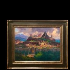
Treamayne Posted November 25, 2023 Report Share Posted November 25, 2023 (edited) 6 hours ago, Nightstar The Bright said: On 11/23/2023 at 8:09 PM, Treamayne said: Which imples that Hallendren is on the North Shore of the Bright Sea. She does indeed, but why does this mean that Hallandren is on the northern shore, The coppermind tells us it’s on the western side, the map of T’Telir also shows us this, though the sea could be shaped a little weird and the map would still work. Two reasons: I was tired and didn;t quite follow all of the branches of logic to their conclusion In that I didn't fully consider NW and NE corners so much as I was trying to mentally map the line of travel South from the mountains, South into the City and Couth onto the Court plateau This section of Ch 4 implies that the T'Telir Map is not oriented North Up: Spoiler Ch 4: Quote As the carriage climbed the southern section of town, she could see—through gaps in the buildings—that the Bright Sea broke into a bay before the city. T’Telir curved around the bay, running right up to the water, forming a crescent shape. So, at least to me, when looking at the map, the plateau on which the Court of the Gods is found is just-below-Central on the Map's vertcal axis. For her to mention "climbing South" and the CotG to be in Southern T'Telir - that means this map is oriented East Up. Map: Spoiler Edited November 25, 2023 by Treamayne Clarity 0 Quote Link to comment Share on other sites More sharing options...
Nightstar The Bright Posted November 25, 2023 Author Report Share Posted November 25, 2023 17 minutes ago, Treamayne said: This section of Ch 4 implies that the T'Telir Map is not oriented North Up: Please explain, she was already travelling through the city for a while, she probably traveled the entire way through the city (from the north to the south) and then a mention was made that she was climbing the southern section (with the court, where she was headed.) That and the fact that the Bright sea is located to the east both in the book and in the map, leads me to believe that the map is north side up. 1 Quote Link to comment Share on other sites More sharing options...
Treamayne Posted November 25, 2023 Report Share Posted November 25, 2023 4 minutes ago, Nightstar The Bright said: That and the fact that the Bright sea is located to the east both in the book and in the map Please cite your source for the Inner Sea to be East of T'Telir in the story. Because my whole point is that I do not think the map is North Up - which makes what you are calling East on the map is actually South. Here's what I found for East in-story: Spoiler Ch 12: Quote Siri stood in the dark black bedroom, wearing her shift, looking out the window. The God King’s palace was higher than the surrounding wall, and the bedroom faced east. Out over the sea. She watched the distant waves, feeling the heat of the afternoon sun. Non-definitive, since it only says the window points East and the Sea is visible from the window. Ch 32: Quote The people of Chedesh still dominated the world. They sailed the Inner Sea, coming from the east, and it was they who first discovered this strange land. Their writings are sparse, their empire has long since been taken by the dust, but memory remains. Also non-definitive since it only says the Chadesh sailed from the East, which means T'Telir and the bay could be on the N, NW or W shore. I'm not saying you are wrong. I am saying there is not enough definitive information to reliably say what direction the bay lies from T'Telir, and on which shore of the Bright Sea the bay is located. Indications, yes. Likeihoods, yes. Definitive answers, no. 0 Quote Link to comment Share on other sites More sharing options...
alder24 Posted November 25, 2023 Report Share Posted November 25, 2023 (edited) 49 minutes ago, Treamayne said: So, at least to me, when looking at the map, the plateau on which the Court of the Gods is found is just-below-Central on the Map's vertcal axis. For her to mention "climbing South" and the CotG to be in Southern T'Telir - that means this map is oriented East Up. In my opinion this map and quote doesn't suggest that. It means that as she gained elevation, there were fewer buildings between her and the sea (in whatever direction it was) thus she could see it in between buildings. Additionally determining the direction in which the main body of the sea is located based on the small map is hard. The city is said to be in the bay, so there are at least 3 sides where it can be located. Just because on the grand scale the city is located on the western shore of the sea, doesn't mean that the city's port has to be facing east - it can even face west if the bay is large enough. Just look at the San Francisco Bay. Personally I think that the map is oriented north up, as I see no reason why it would be otherwise, but everything is possible. However, because it was said in the quote that " the Bright Sea broke into a bay before the city" it implies there is no sizable land obstruction between the bay and the sea, the bay is open and the port is facing east towards the open bay and the sea. Thus the map is north up. Edited November 25, 2023 by alder24 1 Quote Link to comment Share on other sites More sharing options...

Recommended Posts
Join the conversation
You can post now and register later. If you have an account, sign in now to post with your account.